Precision on the Water: Mastering Advanced Dinghy Data Systems
Introduction: The New Frontier of Dinghy Performance
In elite competitive sailing, the margin between victory and mid-fleet obscurity is measured in fractions of a degree and grams of tension. To win, you must stop guessing and start measuring. This guide establishes a professional-grade workflow for integrating high-tech sensors—including ultrasonic wind meters and load cells—into your Europe dinghy or similar high-performance craft. By following this systematic approach, you will transform raw on-water data into actionable intelligence, allowing for precise sail development and tactical refinement.
Tools and Materials Needed
Victory requires the right gear. To execute this data-driven strategy, you need a synchronized ecosystem of hardware and software:
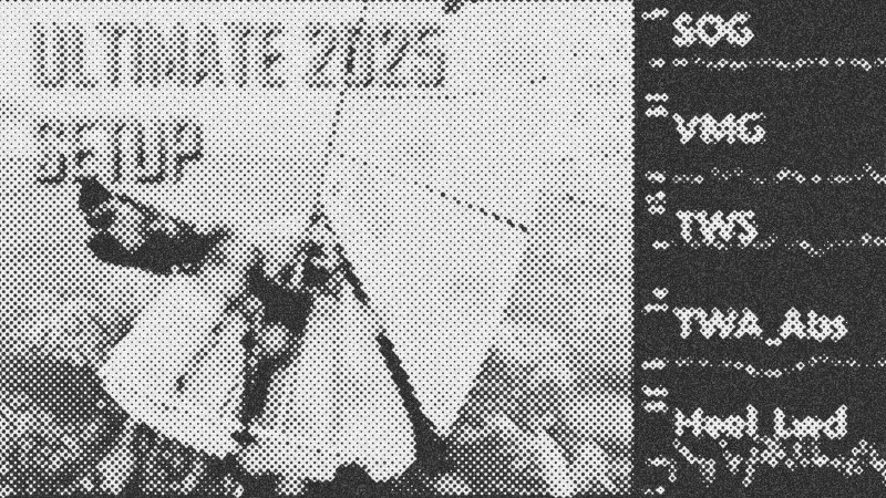
- Vakaros Atlas 2: The central hub for GPS, magnetic heading, and motion sensing.
- Calypso Ultrasonic Portable: A wireless wind sensor to capture apparent wind speed and angle.
- Cyclops Atto: A Bluetooth load cell to monitor mainsheet and leech tension.
- GoPro (with GPS enabled): For visual trim analysis and time-code syncing.
- Nord Analytics: The software platform for data processing and calibration.
- DJI Wireless Mic: For recording real-time tactical commentary.
Step 1: Hardware Integration and Setup
Mount your Calypso Ultrasonic Portable sensor at the bow or on a dedicated pole. While mounting on the mast might seem intuitive, mast rotation in a Europe dinghy introduces constant orientation errors. Instead, mount it to the deck to maintain a fixed reference point. Place your Vakaros Atlas 2 on the bulkhead where it is visible but secure. Attach the Cyclops Atto load sensor to your mainsheet system. This provides a direct window into your leech tension, a critical variable for upwind speed. Ensure all devices are paired via Bluetooth to the Vakaros Atlas 2 log to centralize your data capture.
Step 2: On-Water Data Collection
When recording, use a flat color profile on your camera to maximize dynamic range and keep file sizes manageable. Record at 1440p (4:3 aspect ratio) to capture the full mast and sail plan without digital warping. Crucially, keep GPS enabled on your camera. Internal camera clocks are notoriously unreliable; the Nord Analytics software requires the GPS time code to perfectly align your video frames with the sensor logs from your Vakaros Atlas 2. Utilize a wireless mic in a waterproof pouch to narrate your feel and tactical decisions; this adds the "why" to the "what" during later analysis.
Step 3: Calibration and Error Correction
Raw data is often a mess of systemic errors. Once you upload your logs to Nord Analytics, you must perform two critical calibrations. First, correct the Compass Heading. If your Vakaros Atlas 2 is slightly askew on the bulkhead, apply a metric offset (e.g., -3.2 degrees) until your heading and course over ground align correctly across both tacks. Second, address Upwind Wake Effect. Wind is pre-bent by the sail before it hits your sensor, often creating a false "lift" on both tacks. Quantify this error—typically around 5 degrees—and apply a formula to recalculate your apparent wind angle. This cascading recalculation will then correct your True Wind Direction and Velocity Made Good (VMG).
Tips and Troubleshooting
- Surface Friction: Remember that sensors mounted 1.5 meters above the water will record lower wind speeds than meteorological reports, which measure at 10 meters. Don't let the lower numbers rattle you; they are the reality of the air your sail is actually using.
- Stabilization: Turn off digital stabilization on your fixed-mount cameras. You want to see the real-life movement and pitch of the boat, not a digitally smoothed version that hides your technical flaws.
- Syncing: If your video and data feel off, check the GPS time lock. Without it, the manual syncing process becomes a grueling hurdle.
Conclusion: Turning Data into Gains
The objective is a perfectly calibrated digital twin of your sailing session. By aligning your load cell data, wind angles, and video, you can send precise screenshots of sail profiles to your designer and correlate leech tension with peak VMG. This is how champions are made: through the relentless pursuit of objective truth on the water.
- Vakaros Atlas 2
- 31%· products
- Calypso Ultrasonic Portable
- 15%· products
- Cyclops Atto
- 15%· products
- Europe dinghy
- 15%· products
- Nord Analytics
- 15%· products
- John Reese
- 8%· people
The Most Advanced Dinghy Tech Setup for 2025!
WatchTHE FOIL // 22:35

The Foil is a new wave of racing media. We are a fresh, all-new, proudly independent digital media brand dedicated to the sport of sail racing. Our focus is centred around the major peaks of the international sport: SailGP, the America’s Cup and the Olympic Games, plus offshore classes and events, and the diverse wider world of sailing competitions that take place around the globe. Become a member now: https://www.youtube.com/@WeAreTheFoil/join